Many maps have been produced of Atlanta and the surrounding area over the two hundred years since the beginning of white settlement and reliable mapping of the western Georgia piedmont after the War of 1812. These below I have found the most useful. All are in the public domain or are scans from the author's own collection of maps. Most images are linked to larger images. Three collections of historic maps are especially helpful in continuing research: the David Rumsey Map Collection, the Geography and Map Division of the Library of Congress, and "County Maps" at Georgia's Virtual Vault, Georgia Archives.
|

Topographical Engineers Office, Army of the Cumberland,
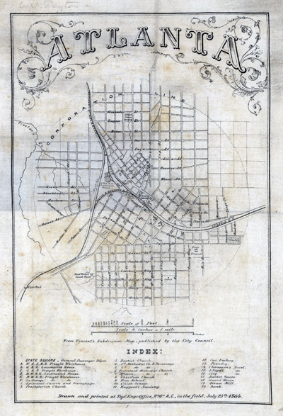
"Atlanta, from Vincent's Subdivision Map, drawn and published in the field, July 25, 1864."(Library of Congress, Geography and Map Division) |
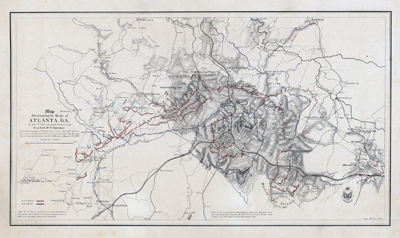
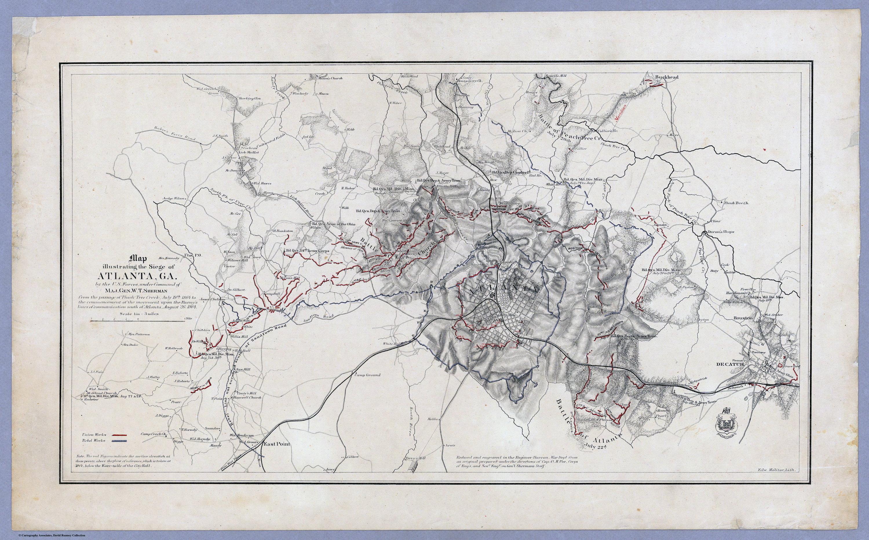
Orlando M. Poe, Senior Engineer, "Map illustrating the Siege of Atlanta, Ga. by the U.S. Forces, under Command of Maj. Gen. W.T. Sherman from the passage of Peach Tree Creek, July 19th 1864 to the commencement of the movement upon the Enemy's Lines of communication south of Atlanta, August 26, 1864."(Library of Congress, Geography and Map Division) |
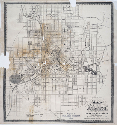
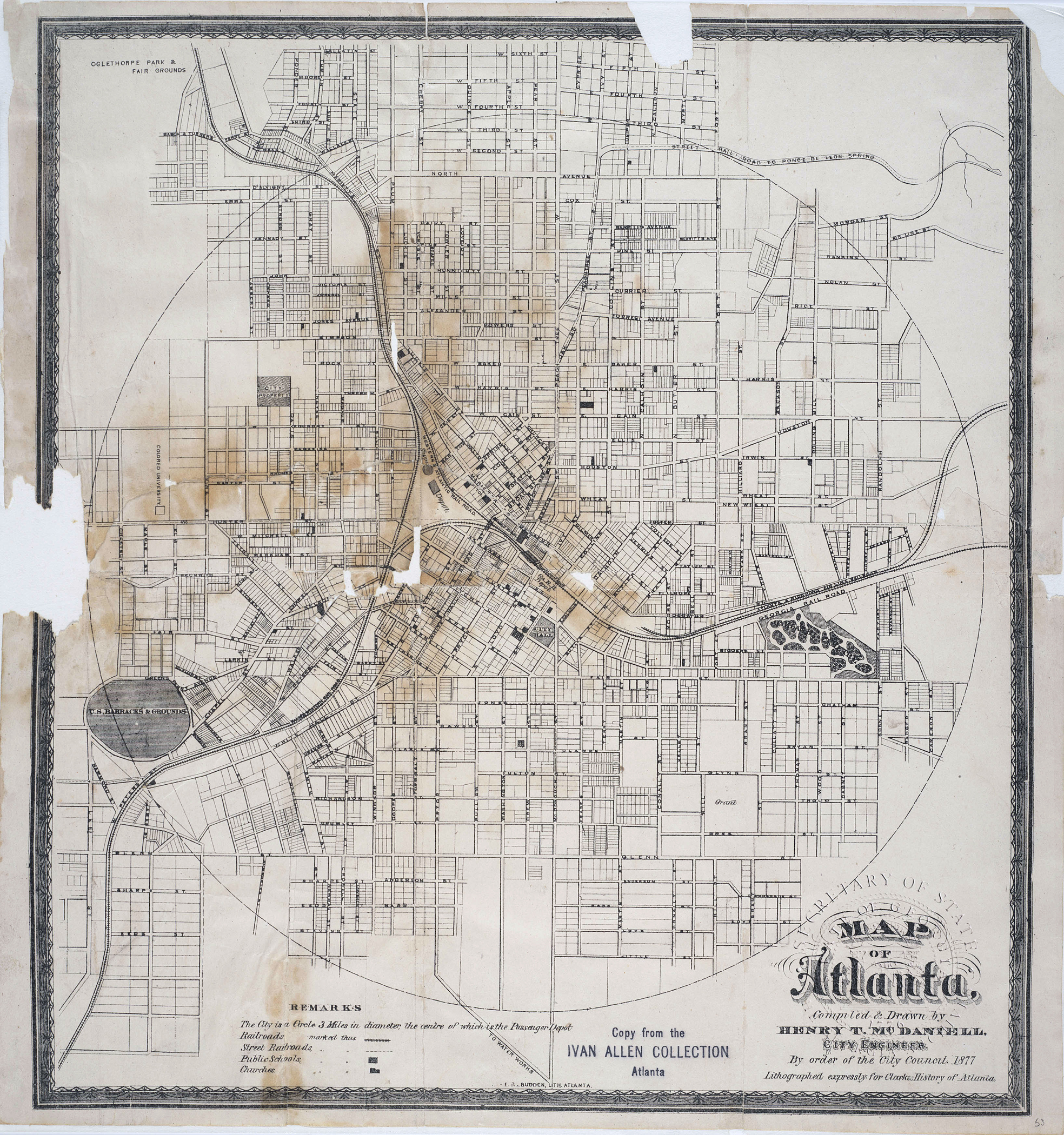
Henry T. McDaniel, City Engineer, Map of Atlanta, 1877. (Georgia Department of Archives and History) |
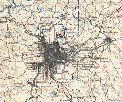
Detail from Atlanta quadrant, U. S. Geological Survey, surveyed in 1887-1888, edition of Sept 1895, reprinted June 1900. (scanned from author's collection) |
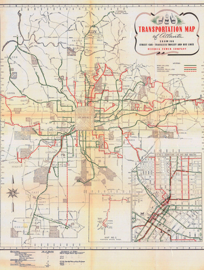
Georgia Power Company, "Transportation Map of Atlanta showing street car, trackless trolley and bus lines," 1942. (scanned from author's collection) |
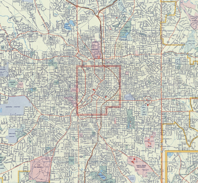
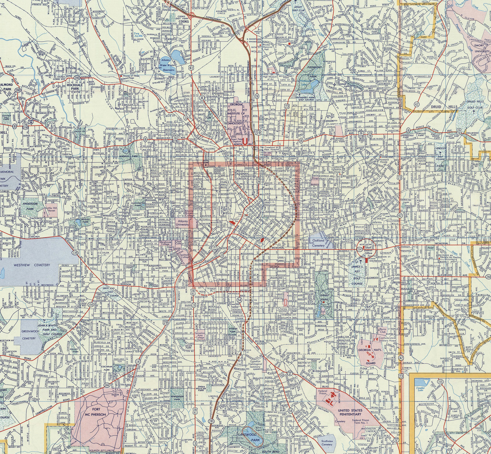
Detail from Shell Oil Company road map, 1956, at a point when the Downtown Connector had been mapped but not completed. (scanned from author's collection) |
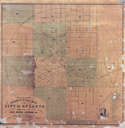
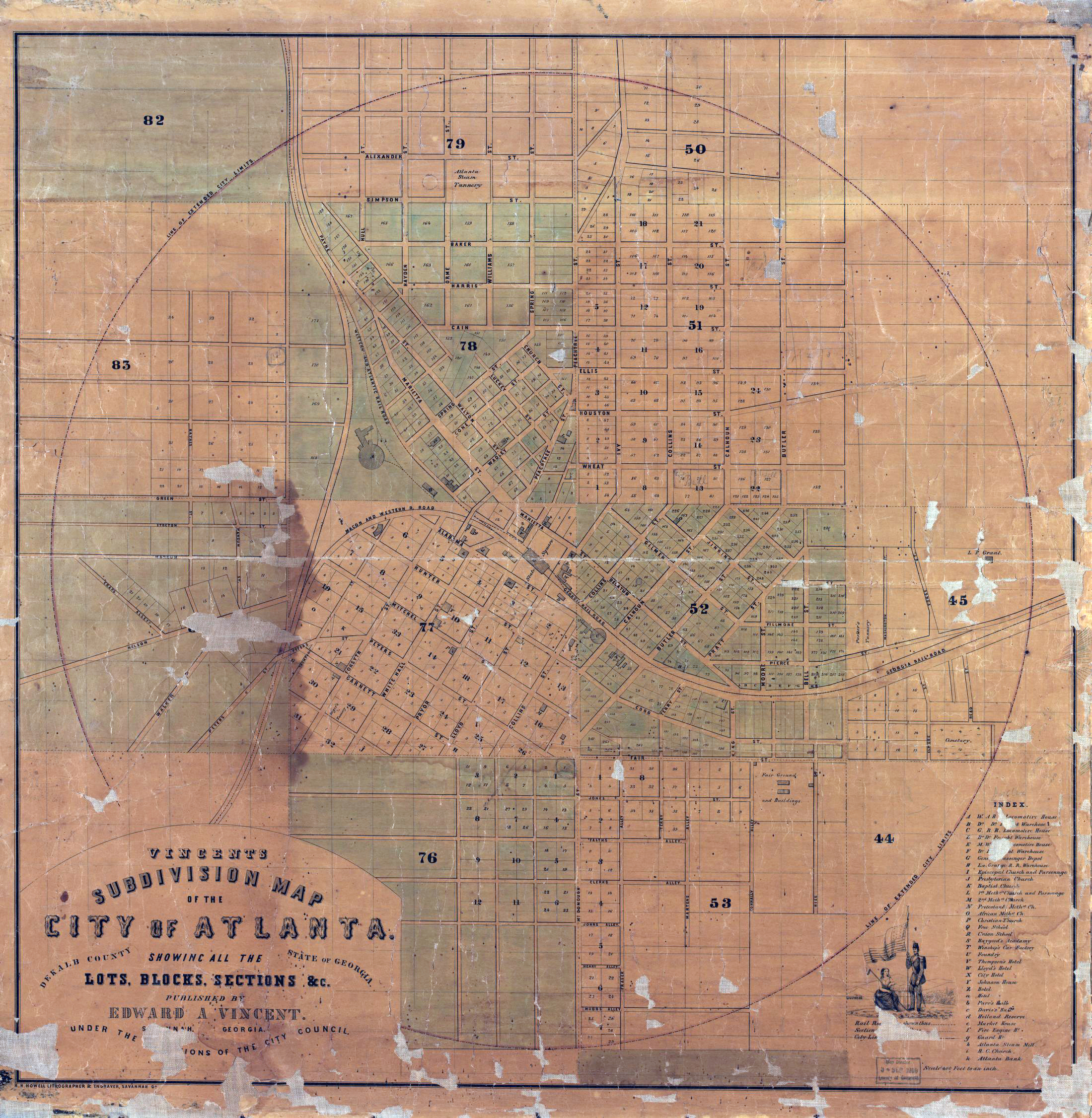
Edward A. Vincent, "Vincent's subdivision map of the city of Atlanta, Dekalb County, state of Georgia : showing all the lots, blocks, sections, &c.," published in Savannah, GA., 1853. (Library of Congress, Geography and Map Division) |
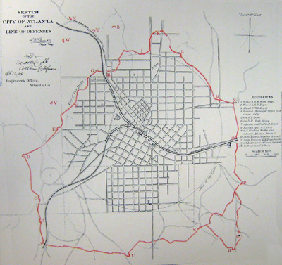
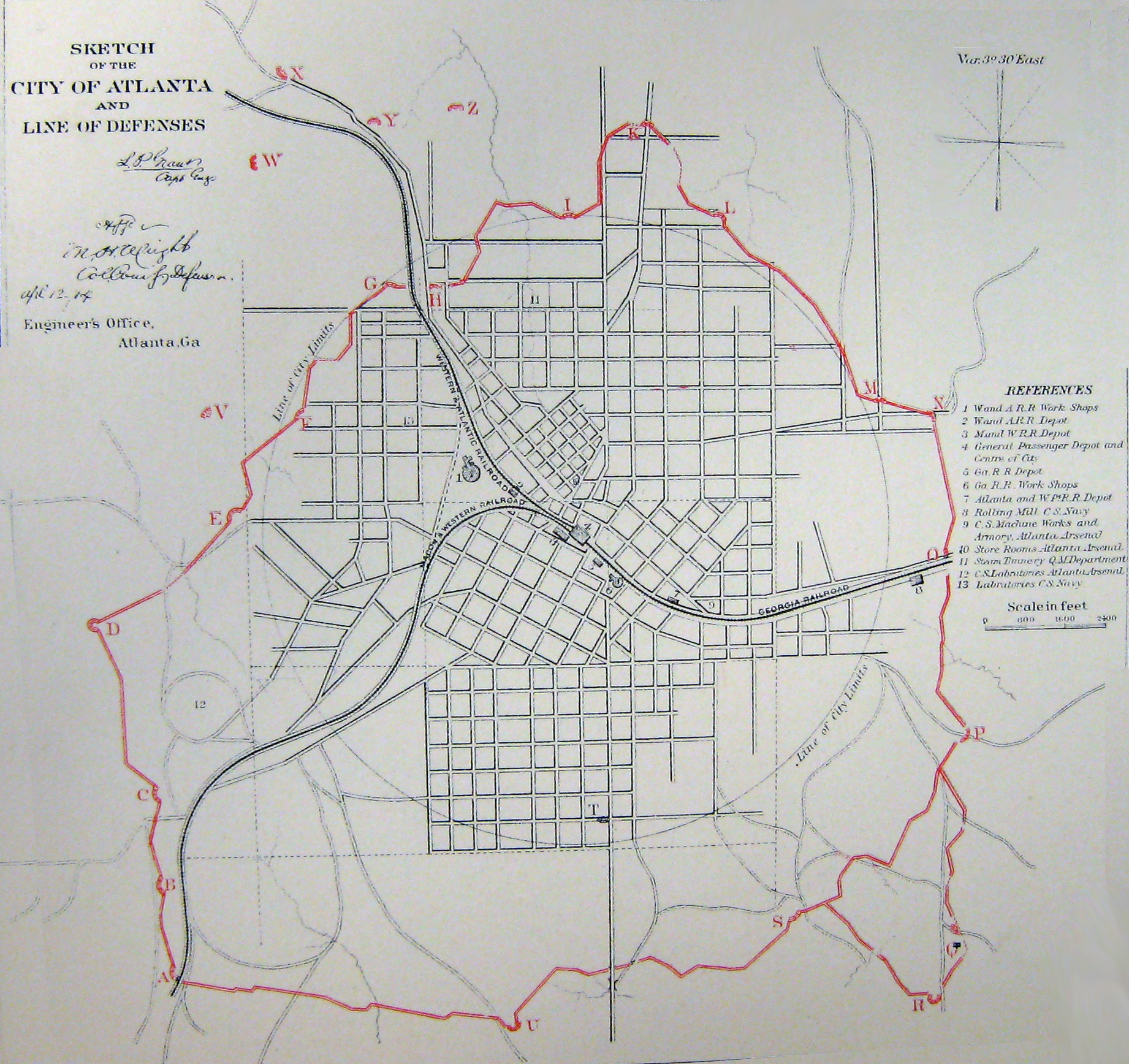
"Sketch of the city of Atlanta and line of defenses," Atlas to accompany the official records of the Union and Confederate armies. Plate 51, map 2, published 1891. (Library of Congress, Geography and Map Division) |
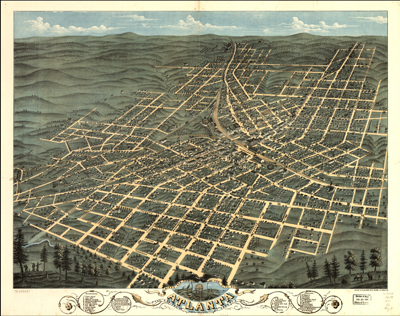
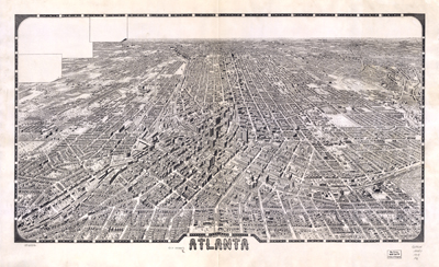
Albert Ruger, "Birds Eye View of the City of Atlanta, the Capitol [sic] of Georgia, 1871."(Library of Congress, Geography and Map Division) |
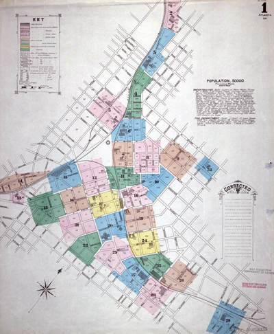
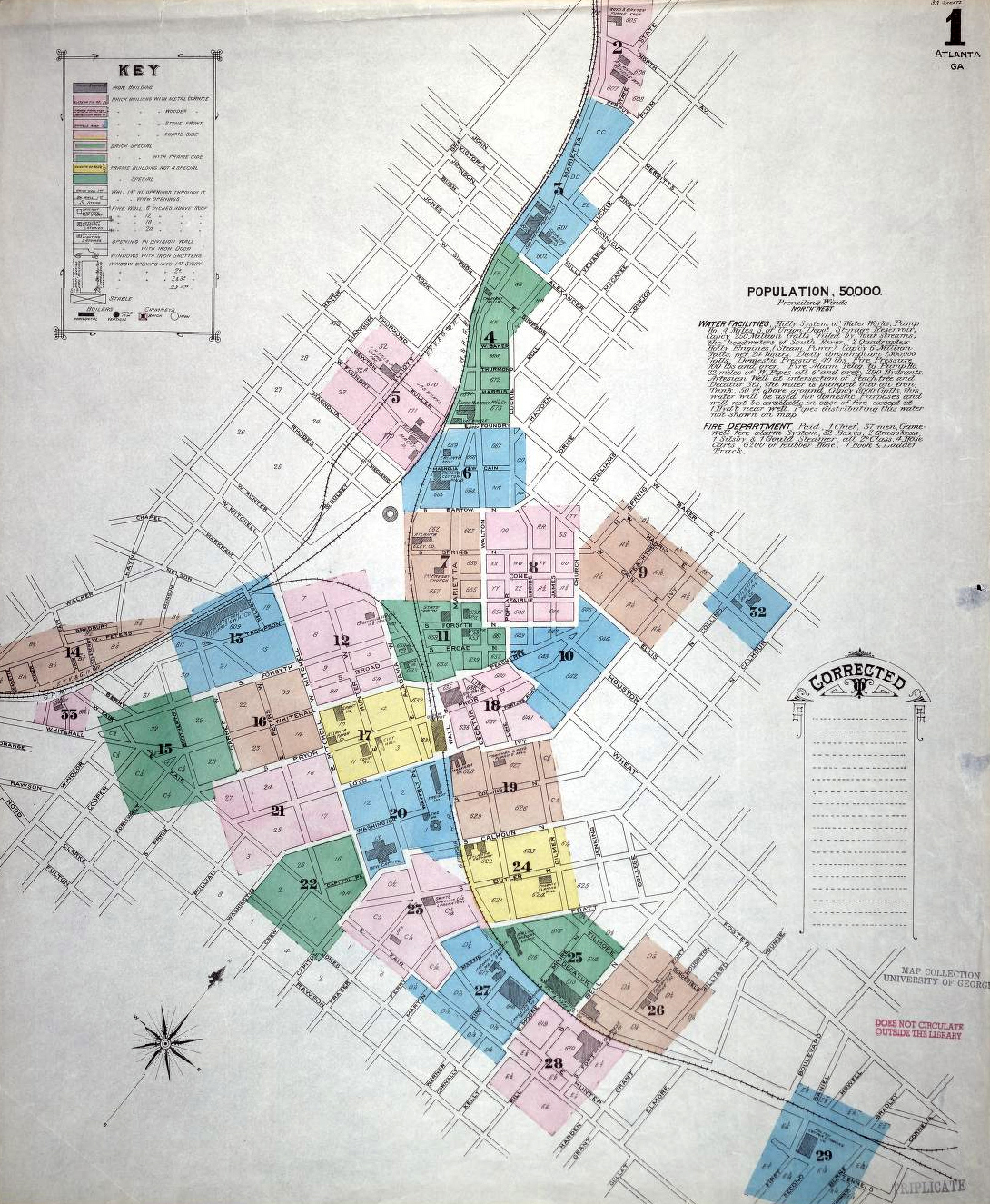
Index map to Sanborn Fire Insurance Company's maps of Atlanta in 1886, the first in a series of Sanborn maps that were produced periodically until after World War II. (Digital Libary of Georgia, <http://dlg.galileo.usg.edu/sanborn>, accessed 26 February 2013) |
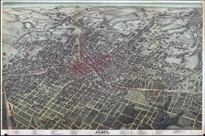
Saunders and Kline, "Birds Eye View of Atlanta, Fulton Co., State Capital, Georgia, 1892." (Library of Congress, Geography and Map Division) |
Foote and Davies, "Atlanta, 1919." (Library of Congress, Geography and Map Division) |
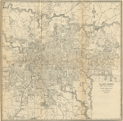
Workers of the Writers' Program, Work Projects Administration, "Atlanta, Georgia," a map included in Atlanta: A city of the Modern South, part of the American Guide Series. (New York: Smith & Durrell, 1942) |
|
|
|