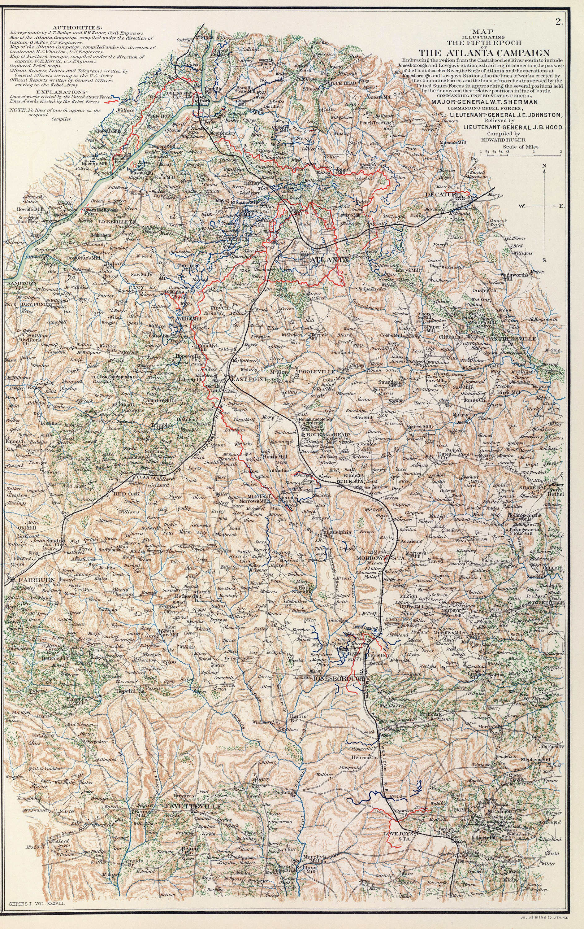
"Map illustrating the fifth epoch of the Atlanta Campaign. Embracing the region from the Chattahoochee River south to include Jonesborough and Lovejoy's Station," part of Plate LX.2, Atlas of the War of the Rebellion, New York : Atlas Pub. Co., 1892. (Library of Congress, Geography and Map Division) |
"Map Showing Battle-field of Peach Tree Creek, Ga., fought July 20, 1864," Plate LX.1, Atlas of the War of the Rebellion, New York : Atlas Pub. Co., 1892. (Library of Congress, Geography and Map Division) |
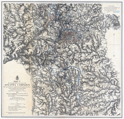
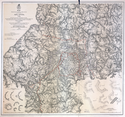
U. S. Army Corps of Engineers, "Map V Illustrating the Military Operations of the Atlanta Campaign."(Library of Congress, Geography and Map Division) |
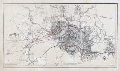
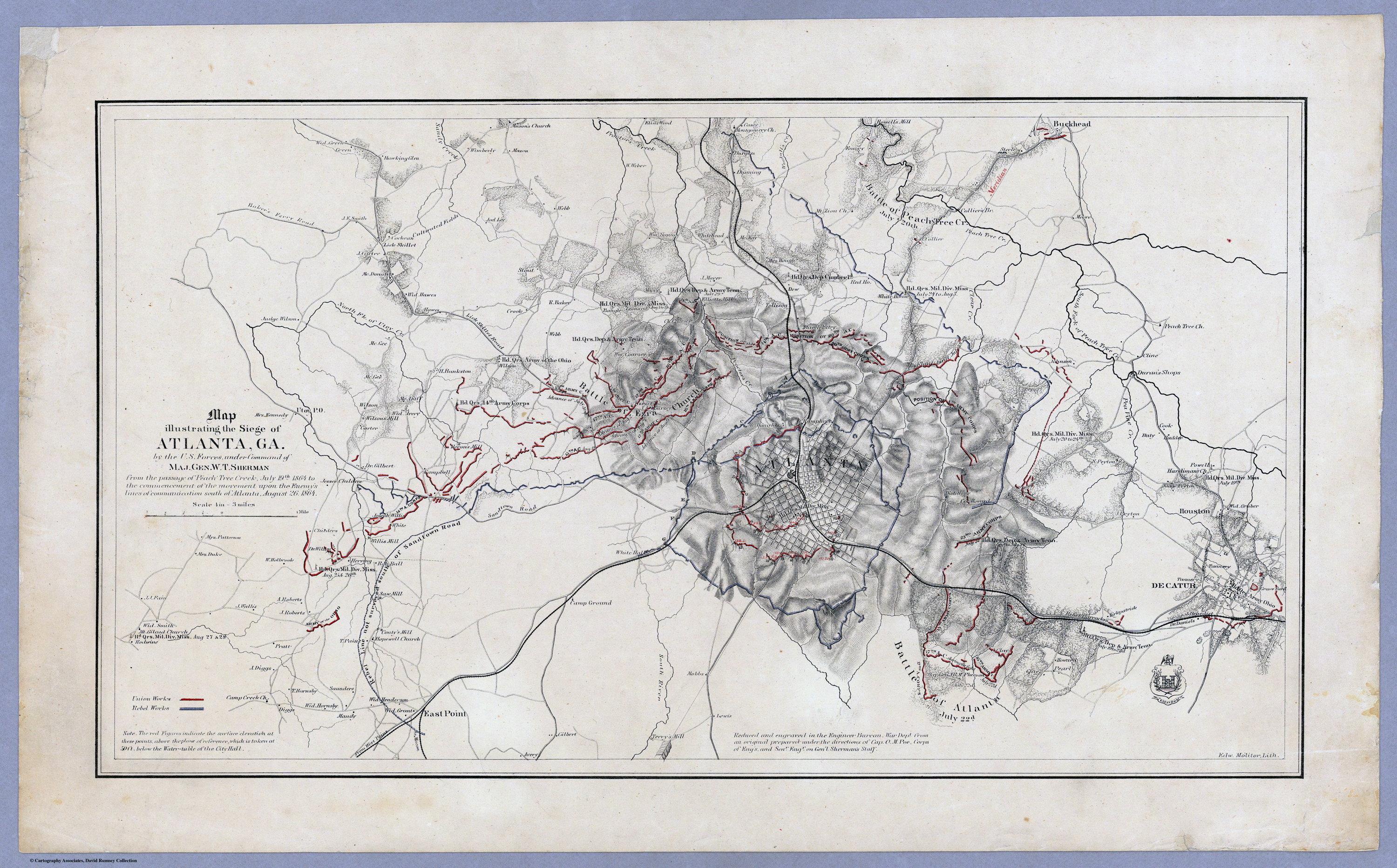
Orlando M. Poe, War Department, "Map illustrating the siege of Atlanta, Ga," lithograph by Edward Molitor, 1864. (David Rumsey Map Collection) |
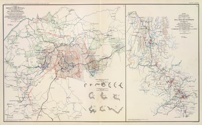
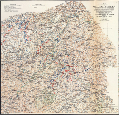
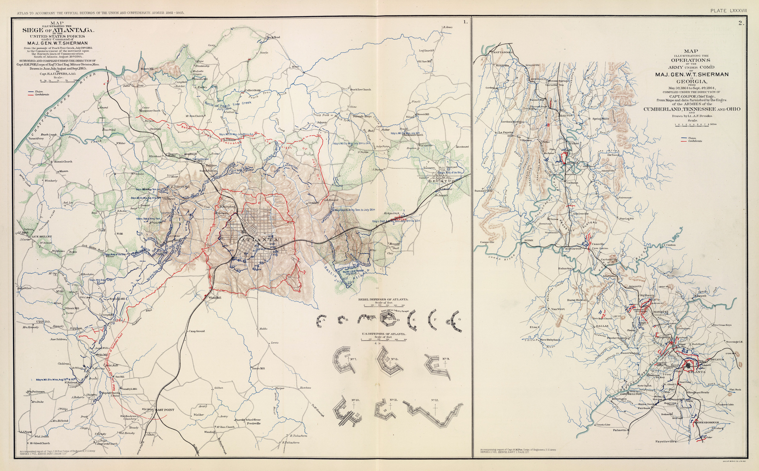
"Map Illustrating the Seige of Atlanta. . .," left, and "Map Illustrating the Operations of the Army under Com'd of Maj. Gen. W. T. Sherman in Georgia from May 5, 1864, to Sept 4, 1864. Atlas of the War of the Rebellion, New York : Atlas Pub. Co., 1892. (Library of Congress, Geography and Map Division) |
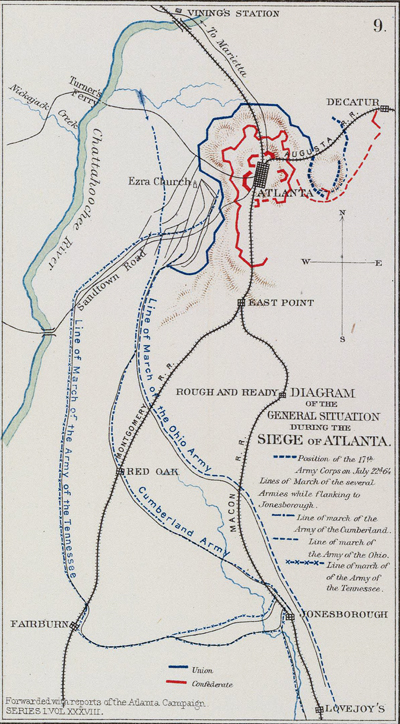
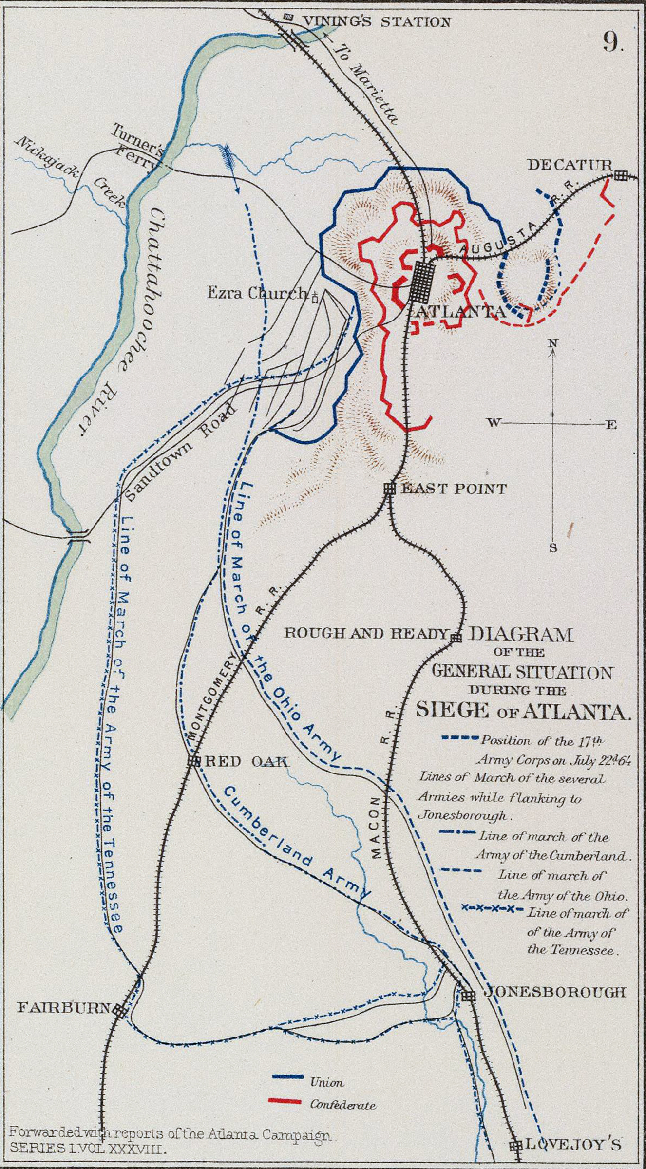
"Diagram of the General Situation During the Siege of Atlanta," Plate LXII, Map 9, Atlas of the War of the Rebellion, New York : Atlas Pub. Co., 1892. (Library of Congress, Geography and Map Division) |
U.S. Army Corps of Engineers, Map Illustrating the Military Operations in front of Atlanta, Ga., from the passage of Peach Tree Creek July 19th 1864 to . . . August 26th 1864, published in New York, Julius Bien & Co., 1875. (Library of Congress, Geography and Map Division) |
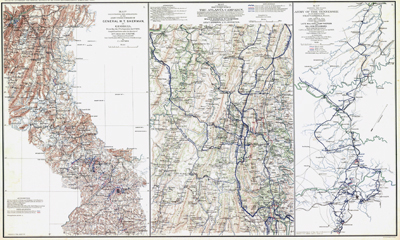
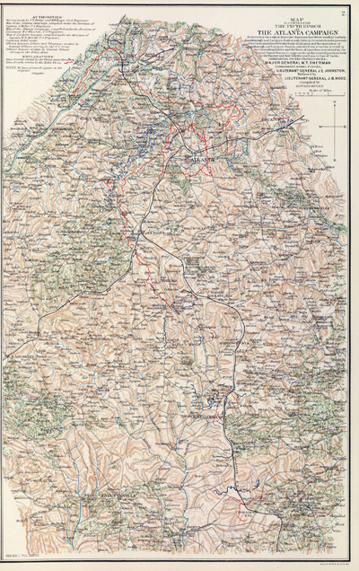
Plate LVII, Atlas of the War of the Rebellion, New York : Atlas Pub. Co., 1892. (Library of Congress, Geography and Map Division) |
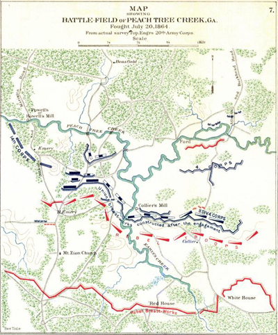
"Map Showing Battlefield of Peachtree Creek, Ga, Fought July 20, 1864," Plate CI, Map 7, Atlas of the War of the Rebellion, New York : Atlas Pub. Co., 1892. (Library of Congress, Geography and Map Division) |
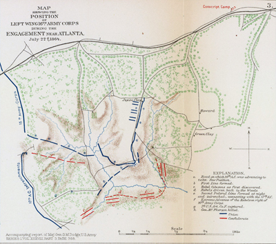
"Map Showing the Position of Left Wing 16th Army Corps during the Engagement near Atlanta, July 22, 1864," Plate LXII, Map 3, Atlas of the War of the Rebellion, New York : Atlas Pub. Co., 1892. (Library of Congress, Geography and Map Division) |
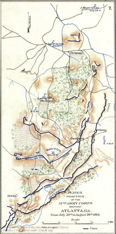
"Position of the 15th Army Corps before Atlanta, Ga. from July 28th to August 26th, 1864," after the Battle of Ezra Church. Plate LIX, Map 7, Atlas of the War of the Rebellion, New York : Atlas Pub. Co., 1892. (Library of Congress, Geography and Map Division) |
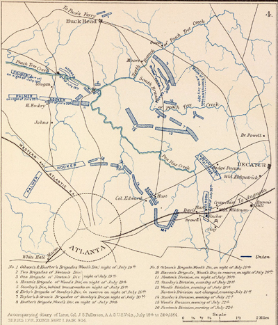
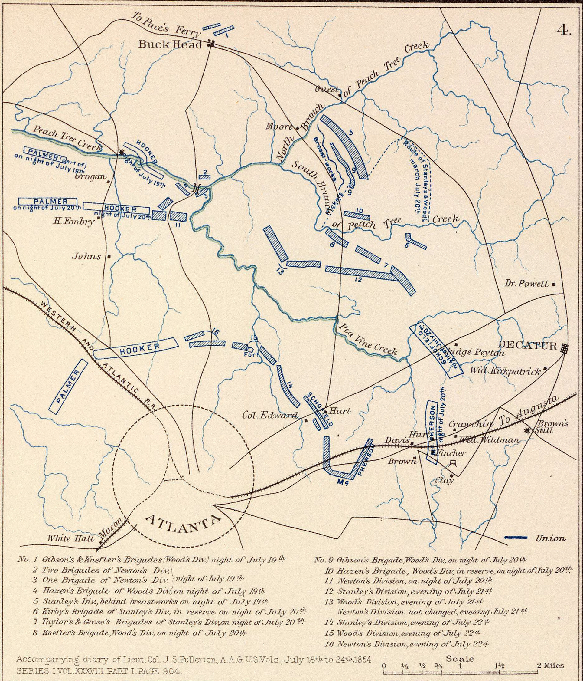
Map 4, Plate LXII, "Accompanying diary of Lieut. Col. J. S. Fullerton . . . July 18th to 24th, 1864," Series I, Vol. XXXVIII, Part I, page 904, Atlas of the War of the Rebellion, New York : Atlas Pub. Co., 1892. (Library of Congress, Geography and Map Division) |
|


